Elevation data are digital representations of the Earth’s surface that contain information about elevations, slopes, terrain, and other topographic features. We create them using technologies such as laser scanning, aerial or satellite photogrammetry, as well as by combining data from various sources.
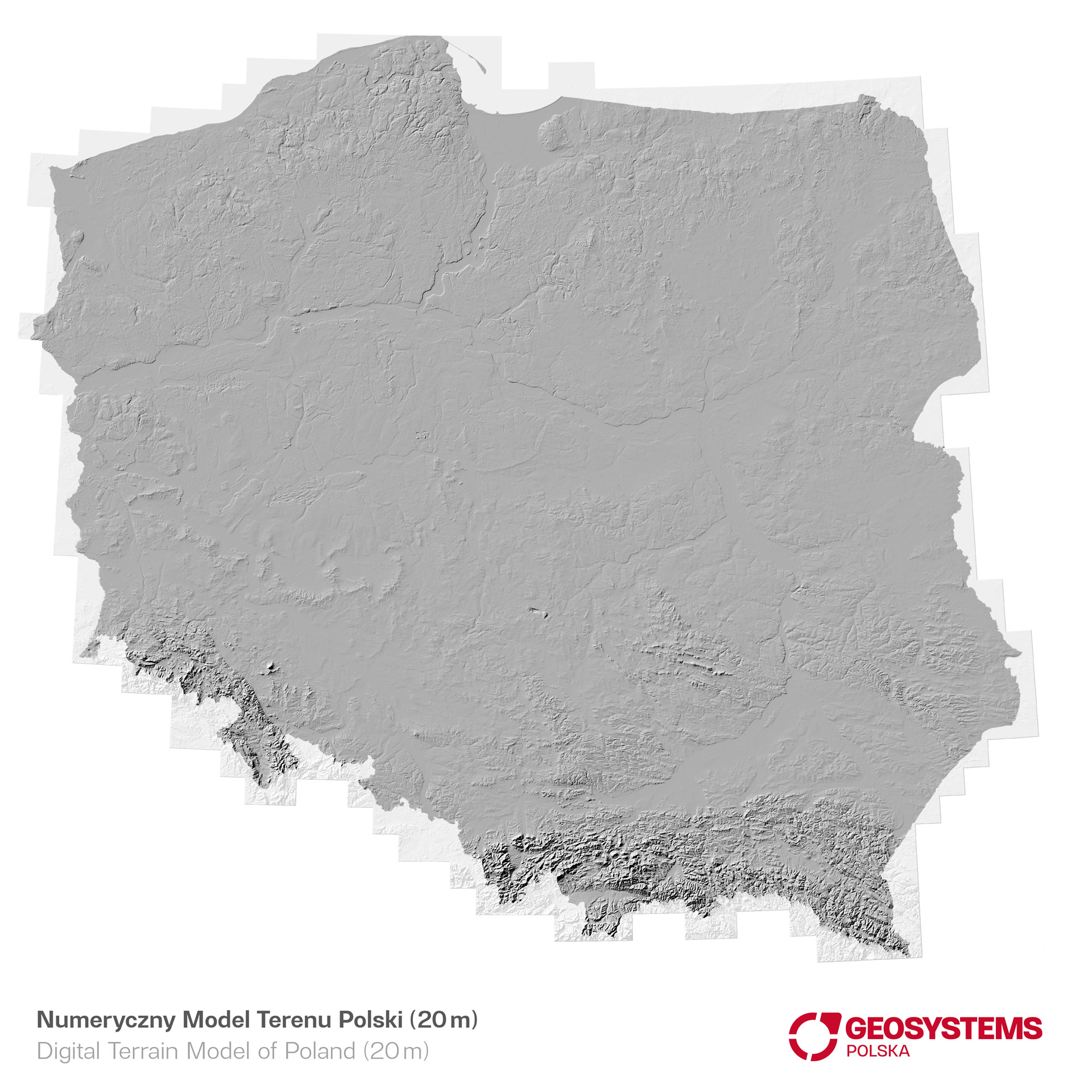
Digital Terrain Model (DTM)
is a record of spatial data containing elevation information about the terrain, excluding objects located on its surface. Most often, it is stored in the form of a continuous raster layer, where the value of each pixel corresponds to the average height of the terrain it represents. Potential applications of DTM include the design of wireless networks and flood risk assessment.
The basic DTM data resource in GEOSYSTEMS Polska consists of data at three levels of detail: DTM 50m, DTM 20m and individually developed DTM 5m.
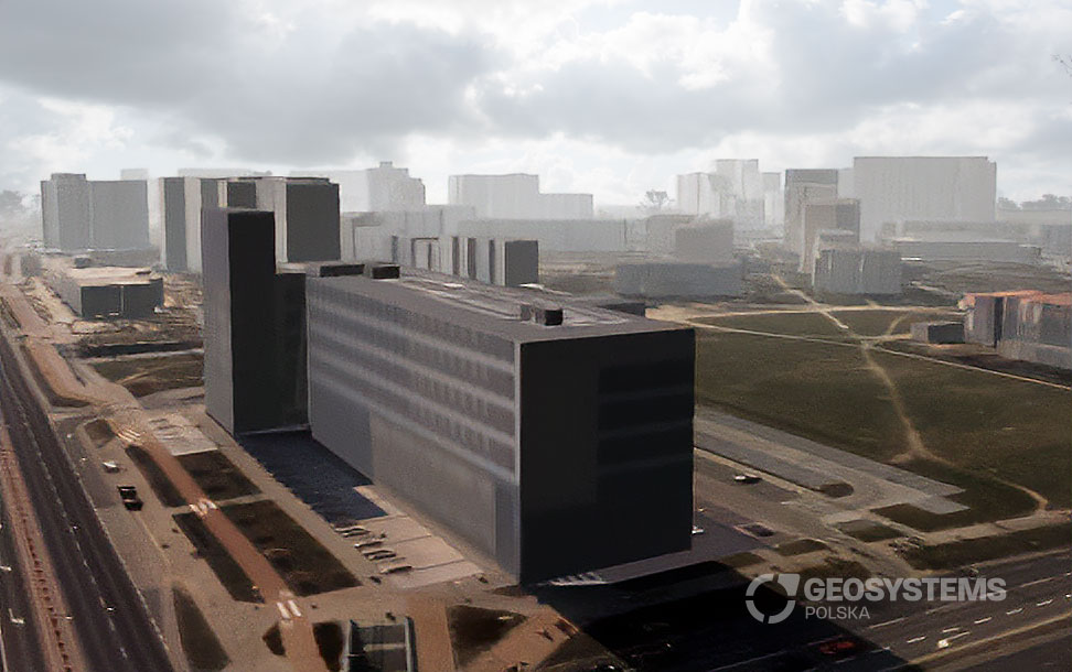
Digital Surface Model (DSM)
Digital land surface models are detailed representations of the Earth’s three-dimensional surface, including buildings, vegetation (trees), infrastructure objects (viaducts, chimneys), etc. DSM are created using advanced measurement technologies, such as laser scanning or aerial photogrammetry.
Digital models of buildings (3D buildings)
A specific version of DSM is a vector height database, containing building blocks and their roof elevations. We have an archive of 3D city models in vector notation. For some applications, building models are equipped with facade and roof textures. Such models are the basis for creating photorealistic sceneries of three-dimensional cities.
We have databases of this type for the largest cities in Poland (including Warsaw, Gdańsk, Kraków, Wrocław, Poznań, Szczecin, Rzeszów).
Adjusting elevation data
Upon individual request, we develop detailed elevation models of selected areas. Elevation data is provided in the user’s required raster format, and if necessary, we develop models in the form of vector irregular triangle networks (TIN).
Application of GIS elevation data:
- Hydrological analyses: DTMs can be used to model water flow, forecast floods, identify areas prone to flooding and analyze water resources, which is extremely important in water management planning, also in the context of areas at risk of drought.
- Urban planning and civil engineering: DTMs can be used to analyze the terrain and determine its potential in terms of infrastructure construction, urban development planning, road layout, location of buildings and other urban elements, forecasting phenomena such as erosion and land subsidence,
- Visibility analyses: DSMs can be used to simulate visibility in various conditions, which is useful in optimizing the placement of surveillance cameras, assessing the impact of new buildings on the view from surrounding areas.
- Propagation analyses: are used in the development of telecommunications broadcasting networks and in planning the location of telecommunications antennas.
- Lighting simulations: using DSM data, you can simulate natural lighting, which is particularly important in the design of urban spaces. Using DTM, supported by DSM, it is possible to indicate the optimal place for a photovoltaic farm, as well as to support analyzes regarding locations for wind farms.
- Spatial planning: DSMs are extremely useful in designing infrastructure such as power lines, water networks and transport networks. They allow for a thorough analysis of the location of existing facilities and optimization of the route or location of new infrastructures, taking into account the topography of the area and terrain facilities.